Drone Mapping & 3D Modeling
Automated flight planning, 3D reconstruction, and AI analysis for construction sites and urban infrastructure.
OspreyX live environment
Why OspreyX
From Flight Planning
to Final Deliverables
OspreyX streamlines the entire drone surveying workflow — from mission design and data capture to 3D reconstruction and analysis. Our platform handles everything construction teams and planners need for accurate, actionable spatial data.
cm
Accuracy with RTK
Multi
Sensor Support
24/7
Cloud Processing
Purpose-Built Technology Stack
3D
Modeling
Combine high-resolution imagery with advanced photogrammetry for centimeter-level accuracy in 3D modeling and terrain mapping.
AI
Analysis
Automated detection of structural changes, surface defects, and terrain features — reducing manual review time while improving accuracy.
Cloud
Processing
Process massive point cloud datasets and orthomosaics in the cloud — from raw drone data to actionable 3D models in hours.
Complete Workflow
End-to-End Drone Surveying Platform
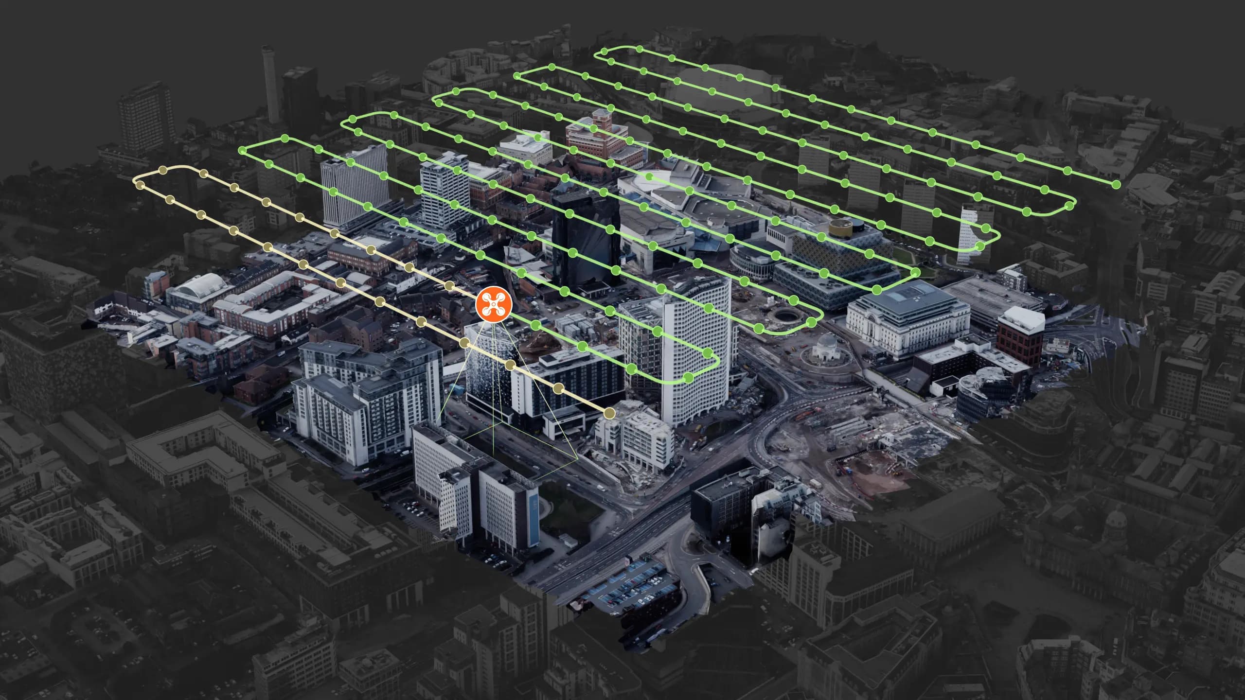
Automated Flight Planning
Design complex survey missions in minutes with intelligent path optimization. Our software automatically calculates optimal altitude, overlap, and GSD for your specific requirements — whether mapping a construction site or surveying urban infrastructure.

3D Reconstruction & Point Clouds
Transform drone imagery into accurate 3D models, digital twins, and georeferenced point clouds. Our photogrammetry pipeline handles massive datasets — from building facades to entire city blocks — with minimal manual intervention.

AI-Assisted Analysis
Leverage computer vision to detect structural changes, identify surface anomalies, and extract measurements automatically. Custom AI models can be trained for project-specific features — from crack detection to vegetation analysis.
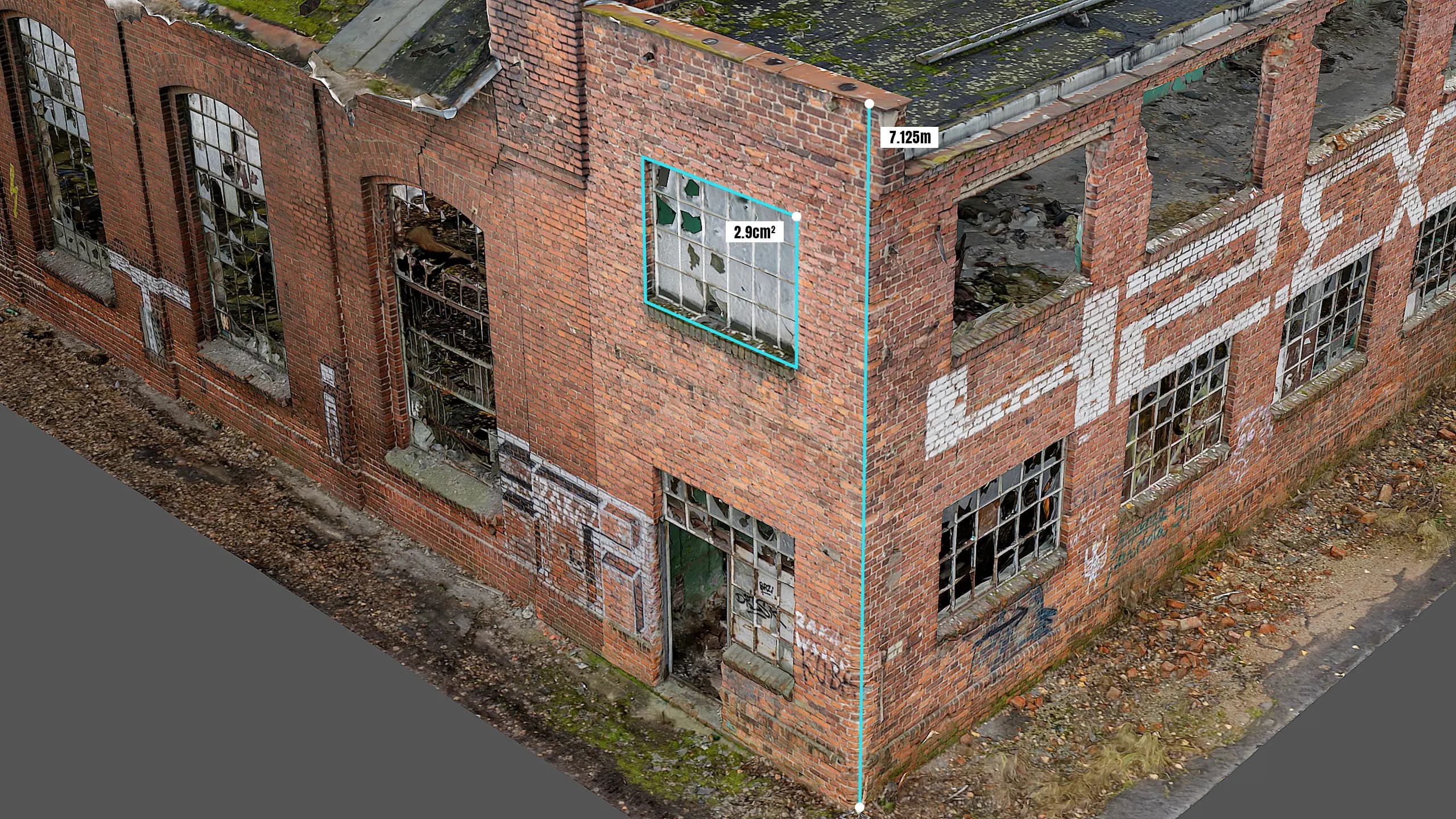
Measurement & Annotation Tools
Extract precise measurements directly from 3D models — calculate volumes, distances, elevations, and surface areas. Add annotations and markups that stay linked to their spatial context for clear team communication.
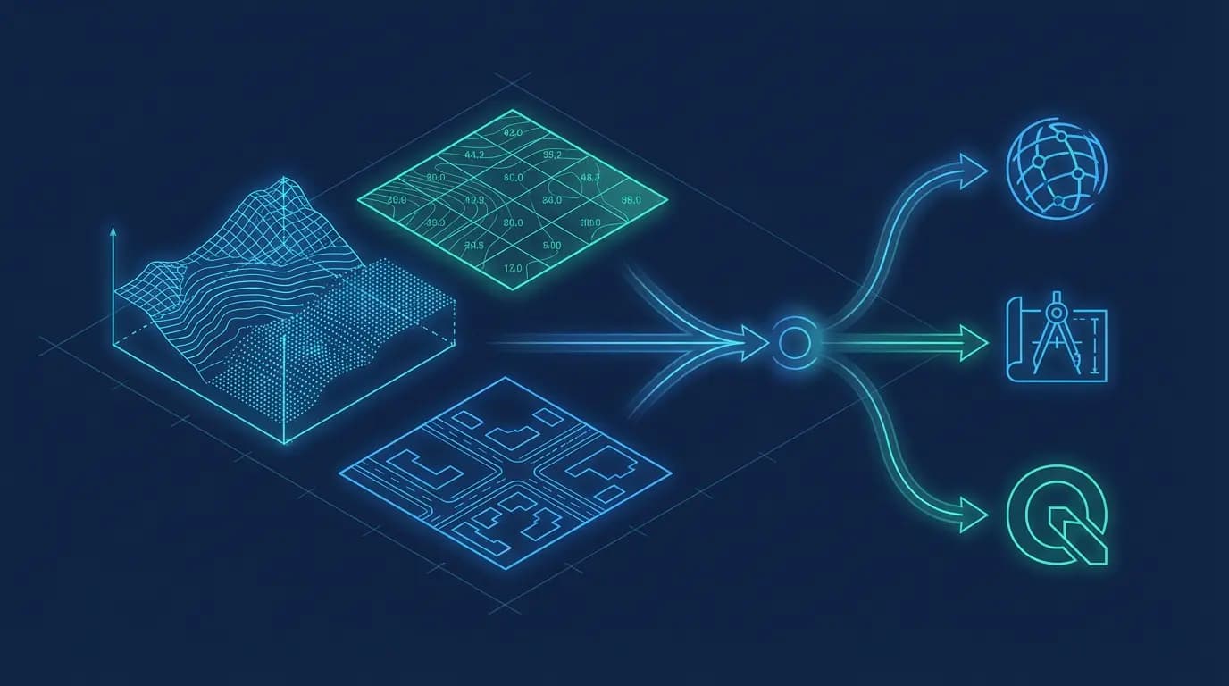
GIS Integration & Export
Seamlessly integrate with industry-standard platforms like ArcGIS, AutoCAD, and QGIS. Export data in multiple formats including LAS, LAZ, GeoTIFF, and DXF while maintaining coordinate accuracy across all deliverables.
Advanced Features
Enterprise-Grade Capabilities
Built for professionals who need reliable, accurate spatial data — from construction managers tracking site progress to urban planners mapping infrastructure.
Multi-Sensor Support
Compatible with RGB cameras, thermal sensors, and multispectral imaging systems for comprehensive data collection.
Offline Mission Planning
Design and execute survey missions without internet connectivity. Sync data automatically when connection is restored.
Coordinate System Accuracy
Full support for local and global coordinate reference systems with RTK/PPK integration for survey-grade precision.
Enterprise Data Security
SOC 2 compliant infrastructure with encrypted storage, role-based access controls, and complete audit trails.
Included with every project:
Professional Drone Surveying Solutions
Get Started with OspreyX
From mission planning to 3D deliverables — we help construction and planning teams capture accurate spatial data.
High Accuracy from Day One
Solution Design
Transparent Pricing & Specs
Live Demo